 | 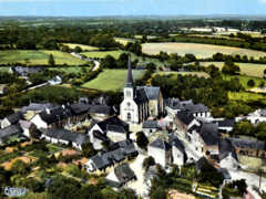 | 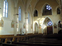 |
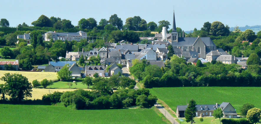
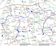
Saint-Thomas-de-Courceriers est une petite commune située à l'ouest de la France dans le département de la Mayenne qui fait partie de la région Pays de la Loire. C'est une région agricole, produisant des céréales, du porc et du bétail (à viande et à lait) - en partie bio. Ses origines remontent à l'époque où la Gaulle fut occupée par les Romains qui construisirent à Couceriers un camp fortifié sur la route menant de Chartres à Jublains. Ils dressèrent également des digues pour inonder la vallée et se protéger ainsi contre les tribus barbares autour d'eux. Plus tard s'éleva sur ce site une forteresse médiévale, dont seules quelques ruines subsistent . Les Anglais la détruisirent en 1419; la chapelle de 1418 existe toujours. Un chateau y fut construit en 1590 dans le style neo-classique, avec des parties ajoutées au 19ème siècle. Malheureusement ce chateau fut démoli en 1960 et il ne reste plus que quelques bâtiments, un portail et un pigeonnier, ainsi qu'une jolie tour qui constitue aujourd'hui un gîte insolite et confortable. |
Saint-Thomas-de-Courceriers is a small commune situated in Western France, in the department of Mayenne and the region of Pays de la Loire. It is an agricultural area with farms producing crops, pigs and cattle (for both meat and milk). Some of these farms specialise in organic produce. Its origins can be traced back to the time of the Roman occupation of Gaul. The Romans, under Caesar, built a fortified camp at Courceriers, on the road from Jublains to Chartres, creating dams which flooded the valley to provide protection from the barbaric local tribes. Later, a medieval fortress was constructed on the site, of which only some ruins survive as it was destroyed by the English in 1419. The 1418 chapel survives. In 1590 a neo-Greek château was built there and extended in the 19th century. Sadly this was demolished in 1960 and only some of the outbuildings, gateway and pigeon loft remain - as well as the pretty bell tower which is now a very unusual and well appointed gîte. |
 |
 |
| Routes, Chemins et Eau / Roads, Footpaths & Water |
| Limit de Commune / Commune Boundary |
| L'information principale |
|
Key Information |
|
Région Département Arrondissement Canton Code INSEE Code postal |
| Pays de la Loire Mayenne Mayenne Bais 53256 53160 |
|
Population Superficie Densité Altitude Longitude Latitude |
| 242 habitants (2009) 12.95 km² 19 hab/km² 142-330 m 0.2667 E 48.2667 N |
|
Region Department District Canton INSEE code Postal code | Pays de la Loire Mayenne Mayenne Bais 53256 53160 | |
|
Population Surface area Density Altitude Longitude Latitude |
| 242 inhabitants (2009) 12.95 km² 19 inhab/km² 142-330 m 0.2667 E 48.2667 N |